Most lists of the best hiking in Portugal are really lists of Madeira’s levadas with a couple of mainland walks tacked on, or roundups of “easy trails” pulled from an app. Neither tells you that Portugal has become one of Europe’s great walking countries in its own right: a 226-km clifftop trail along the wildest coast in western Europe, a glacial valley in the highest mountains on the mainland, a national park where some trails now need a week’s notice, and two archipelagos where the rules changed in 2026. This guide picks the 20 best hikes across the mainland, Madeira and the Azores, with distances, difficulty, the permits and bookings that now apply, the best season for each, and an honest word on which famous walks are overrated.
The short answer: for coast, walk a stretch of the Fishermen’s Trail in the south-west. For mountains, go to Peneda-Gerês or the Serra da Estrela. For drama, walk Madeira’s PR1 ridge, booked in advance. For an easy classic, do the Seven Hanging Valleys in the Algarve early in the morning. Walk in spring or autumn, and in summer only on the islands or at dawn.
Hiking in Portugal: the 20 best hikes at a glance
| # | Hike | Region | Distance | Difficulty | Booking or fee (2026) | Best season |
|---|---|---|---|---|---|---|
| 1 | Fishermen’s Trail (Rota Vicentina) | Alentejo and Algarve coast | 226.5 km in 13 stages | Moderate; soft sand | None | Sept–June |
| 2 | Historical Way (Rota Vicentina) | Alentejo and Algarve interior | ~260 km | Easy–moderate | None | Oct–May |
| 3 | Via Algarviana | Algarve interior | ~300 km | Moderate | None | Oct–April |
| 4 | Camino Portugués, from Porto | North | ~240 km (coastal ~280 km) | Easy–moderate | None; pilgrim credential optional | April–June, Sept–Oct |
| 5 | Seven Hanging Valleys | Algarve | ~5.7 km one way | Easy–moderate | None | Oct–May, or dawn in summer |
| 6 | Lagos to Luz clifftop | Algarve | ~6 km one way | Easy–moderate | None | Autumn–spring |
| 7 | Rocha da Pena | Algarve interior | ~4.7 km loop | Easy–moderate | None | Autumn–spring |
| 8 | Cabo da Roca to Praia da Ursa | Sintra coast | Short, steep | Moderate | None | All year |
| 9 | The Sintra hills | Lisbon area | Various, 5–12 km | Easy–moderate | Palace tickets separate | All year |
| 10 | Serra da Arrábida | Lisbon area | Various | Moderate | None | Autumn–spring |
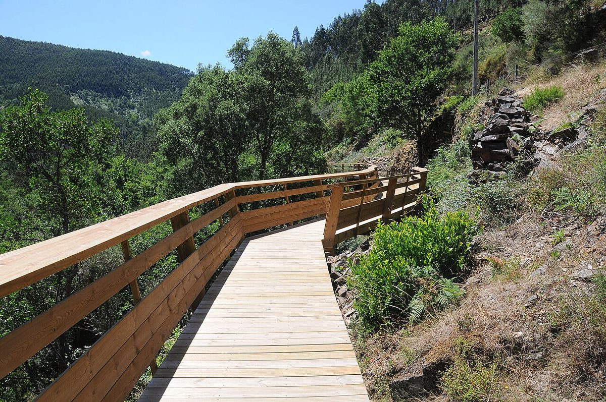
| 11 | Paiva Walkways | North (Arouca) | 8 km | Easy–moderate; stairs | €12 with the 516 bridge; online only | Spring, autumn |
| 12 | The Geira Roman road | Peneda-Gerês | Various | Easy–moderate | Group-size rules apply | Spring–autumn |
| 13 | Pitões das Júnias | Peneda-Gerês | Short loop | Easy–moderate | None for small groups | Spring–autumn |
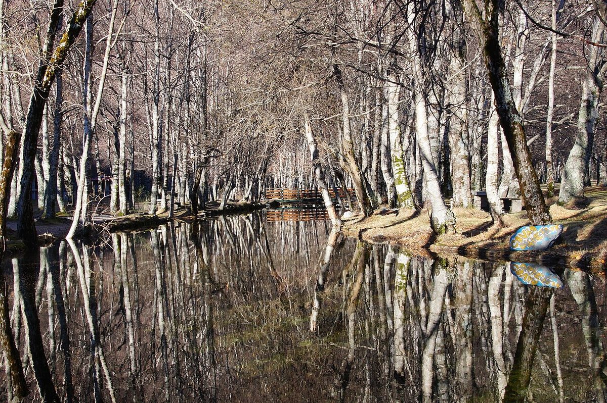
| 14 | The Zêzere glacial valley | Serra da Estrela | Long day | Moderate | None | May–Oct |
| 15 | The schist villages of the Lousã | Central Portugal | Short linking walks | Easy–moderate | None | Autumn–spring |
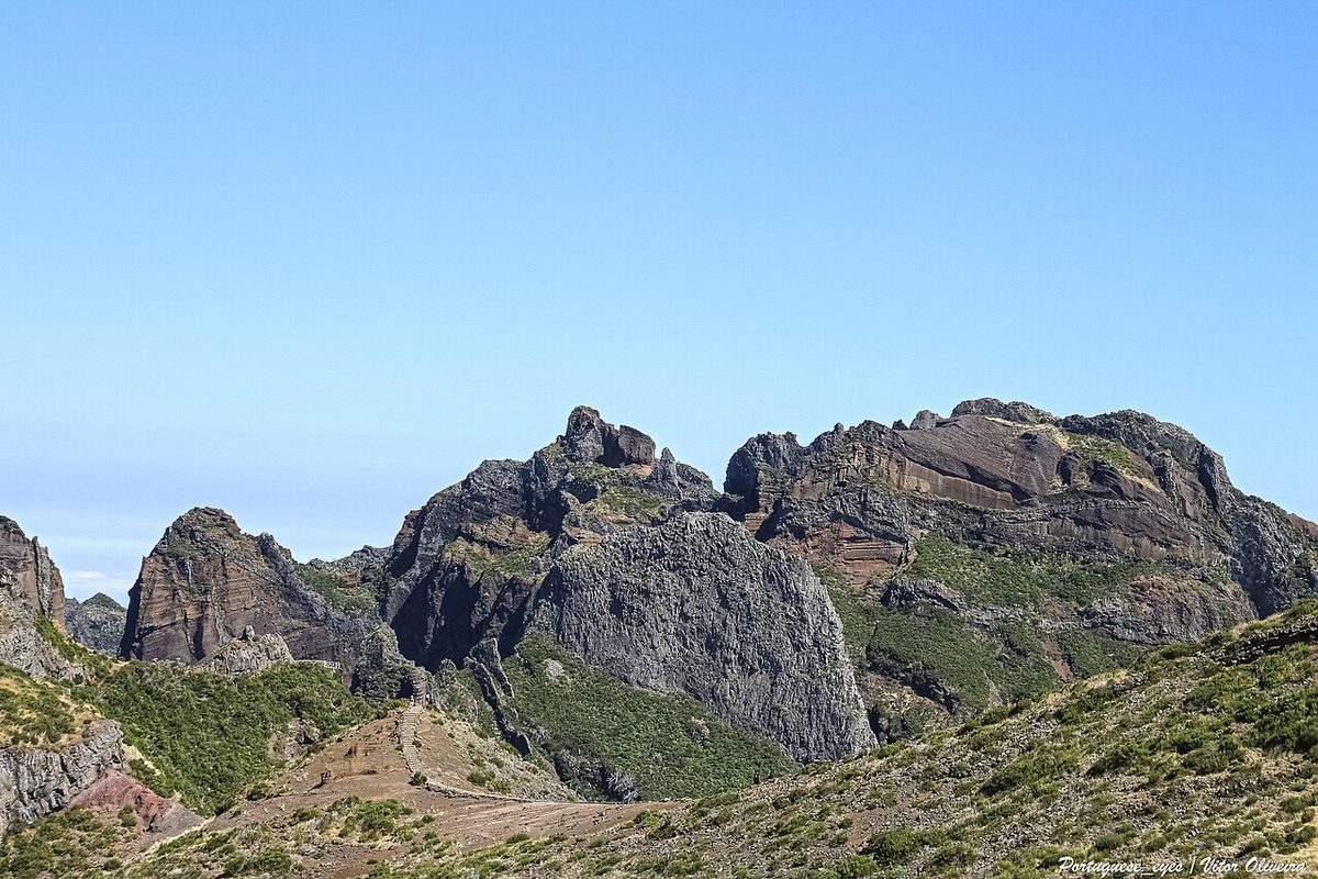
| 16 | Pico do Arieiro to Pico Ruivo (PR1) | Madeira | ~7 km one way + descent | Hard | €10.50, timed, one-way | April–Oct |
| 17 | Levada do Caldeirão Verde (PR9) | Madeira | ~13 km return | Moderate | €4.50, timed | All year |
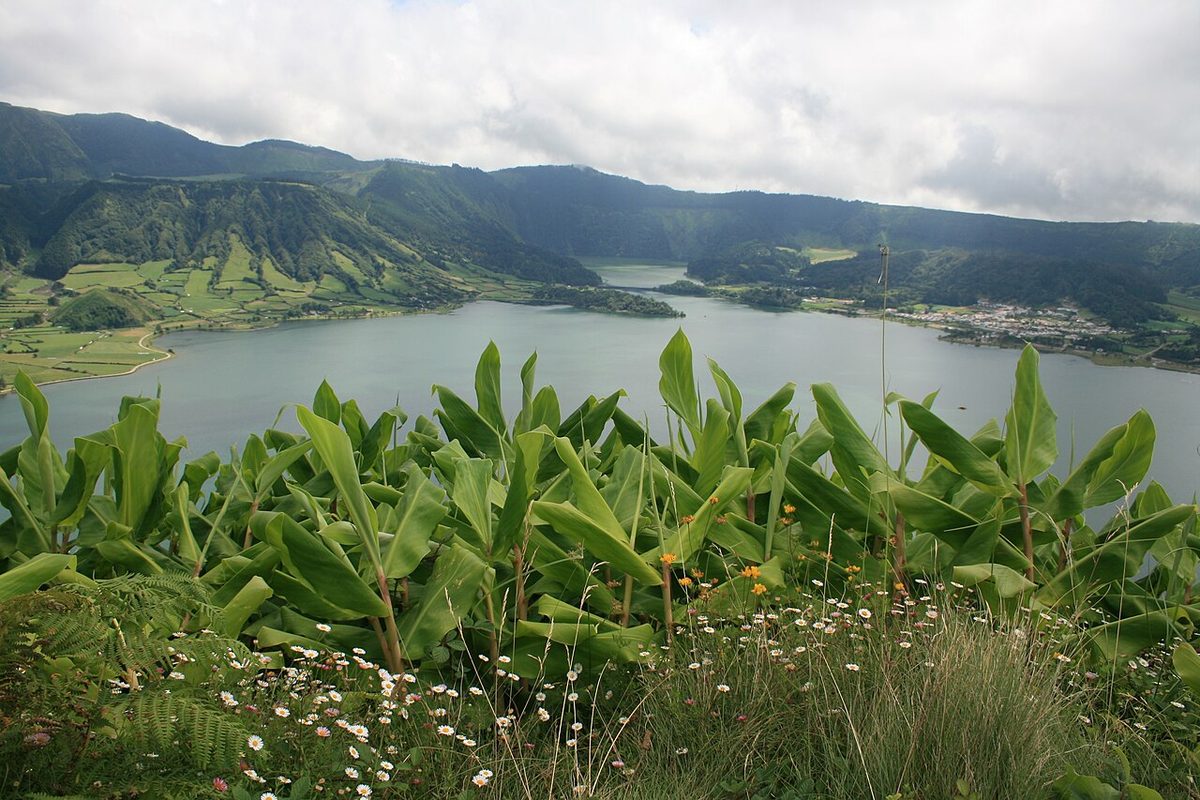
| 18 | Sete Cidades crater rim | São Miguel, Azores | ~10–12 km | Moderate | None | May–Oct |
| 19 | Mount Pico | Pico, Azores | Steep summit climb | Hard | Registration at the Casa da Montanha | May–Sept |
| 20 | The fajãs of São Jorge | São Jorge, Azores | ~10 km descent | Moderate | None | May–Oct |
How to choose: coast, mountain or island
Portugal’s walking falls into three kinds, and they suit different trips. The coast, above all the south-west from the Alentejo to Cape St Vincent and the Algarve’s limestone cliffs, gives you sea views, beaches to swim at the end of the day, a mild climate and easy logistics, but also heat and no shade. The mountains, meaning Peneda-Gerês in the north, the Serra da Estrela in the centre and the smaller ranges such as the Lousã and Arrábida, give you granite, forests, waterfalls and villages, cooler air in summer, and far fewer people. The islands are in a league of their own. Madeira has the levadas and the high ridge, and the Azores have crater lakes and volcanoes, and both are walkable all year, with rules that tightened in 2026.
If it’s your first walking trip to Portugal, I’d choose between a week on the Fishermen’s Trail (spring or autumn) and a week in Madeira (any time of year). If you’ve done both, go to Gerês.
The long-distance routes
1. The Fishermen’s Trail
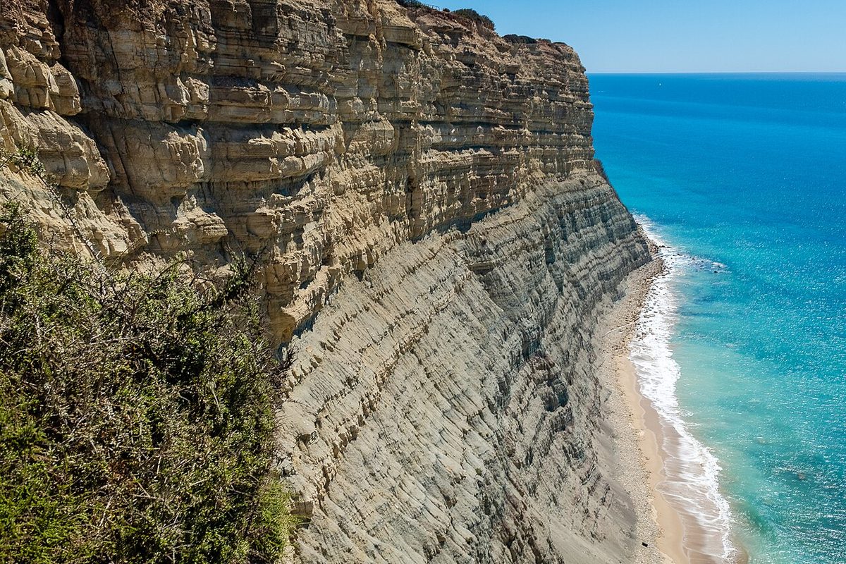
The Fishermen’s Trail is the coastal half of the Rota Vicentina, a network of more than 700 km of waymarked routes in the south-west. It runs for 226.5 km in 13 one-day stages along the clifftops of the Southwest Alentejo and Vicentine Coast Natural Park, from Porto Covo down to the Algarve, and it can be walked in either direction. It follows the paths local fishermen used to reach their rocks: narrow tracks right on the cliff edge, down into sandy coves and across long beaches. The views are extraordinary, but much of the path is soft sand, which makes a 20-km stage feel far longer. The official recommendation is to walk it between September and June, because summer brings heat and there’s no shade.
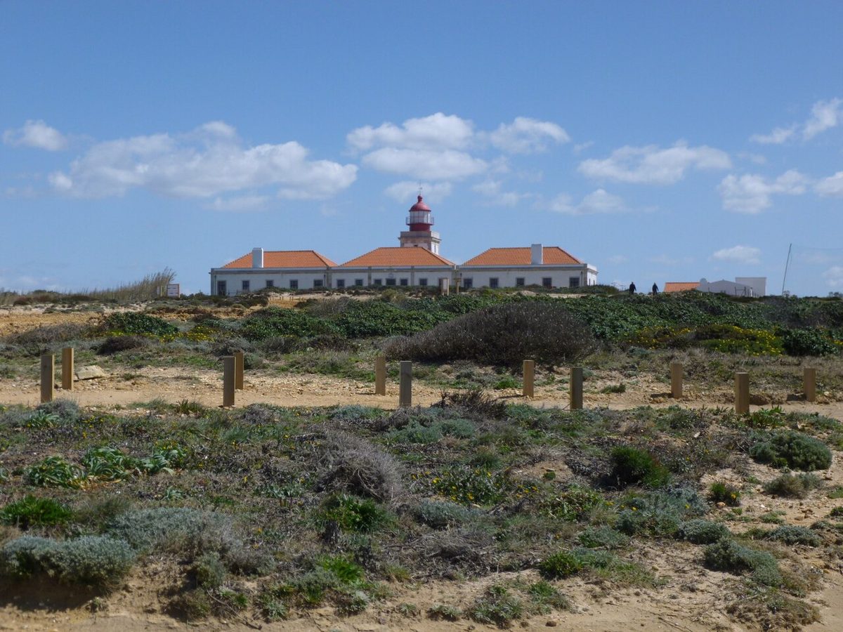
The best single stage: Almograve to Zambujeira do Mar, about 22 km, past Cabo Sardão, where white storks nest on the sea cliffs, one of the few places in the world they do. Verdict: the best coastal walk in Portugal and one of the best in Europe. Walk two or three stages if you can’t do the lot, and use a luggage-transfer service if you’re walking several days in a row. Our Alentejo guide covers the villages along the way.
2. The Historical Way
The inland half of the Rota Vicentina runs for roughly 260 km from Santiago do Cacém to Lagos through cork forest, farmland, river valleys and small white villages, mostly on dirt roads and rural paths. It’s gentler than the Fishermen’s Trail, with firmer ground and some shade, and it shows you the rural Alentejo and Algarve that coastal visitors never see. You can combine the two: the Historical Way to Odeceixe, then the Fishermen’s Trail round Cape St Vincent to Lagos, a total of 274 km. Verdict: a slower, quieter walk, best in spring when the countryside is green and full of flowers.
3. The Via Algarviana
The Algarve’s long-distance route crosses the region’s hilly interior for about 300 km, from Alcoutim on the Guadiana river, on the Spanish border, to Cape St Vincent. It passes through the Serra do Caldeirão, cork and strawberry-tree woods, small villages and the Serra de Monchique, including the Algarve’s highest point at Fóia. It’s the Algarve most visitors never find, and it’s remarkably empty. Verdict: a superb winter walk, when the coast is quiet and the interior is green. Summer inland is far too hot.
4. The Camino Portugués
The Portuguese Way to Santiago de Compostela is the second most popular Camino after the French Way. Most pilgrims start in Porto: the central route is about 240 km and the coastal route about 280 km, each taking around ten to fourteen days to Santiago. The full route from Lisbon is about 620 km. The central route runs inland through Barcelos and Ponte de Lima, with lovely stretches of vineyard and woodland, and crosses into Spain at Valença and Tui; the coastal route follows the Atlantic via Vila do Conde and Viana do Castelo. You can carry a pilgrim’s credential and collect stamps, and there’s a network of pilgrim hostels. Verdict: the obvious choice if you want a multi-day walk with a destination, company along the way and simple logistics. For the towns on the route, see our guide to day trips from Porto and the north.
The Historic Villages route
A long-distance route of several hundred kilometres links the twelve Historic Villages of Portugal along the old Spanish border, including Monsanto, Sortelha, Almeida, Castelo Rodrigo and Piódão. It’s little walked by foreigners and passes through some of the most remote and beautiful country in Portugal. It’s best in spring and autumn. The Central Portugal guide below covers the villages themselves.
The best day hikes on the mainland
5. The Seven Hanging Valleys
The Algarve’s most famous walk, the Percurso dos Sete Vales Suspensos, runs about 5.7 km along the clifftops between Praia da Marinha and Praia do Vale Centeanes, passing Benagil and a series of “hanging valleys”, dry valleys that end abruptly at the cliff edge. It’s easy to follow and packed with views of sea stacks, arches and golden coves. It’s also completely exposed, and hot and busy in summer. Verdict: do it, but at dawn in summer or any time from October to May, and leave the car at one end and taxi back, or walk it both ways. The sea caves below, including Benagil, have strict access rules since 2024, which our Algarve beaches guide explains.
6. Lagos to Luz along the cliffs
West from Lagos, a clifftop path runs past the rock stacks and grottoes of Ponta da Piedade and on along the cliffs to the village of Luz, about 6 km, with a climb over the headland of the Rocha Negra. It’s now part of the Fishermen’s Trail’s Algarve extension. Verdict: an easy, spectacular morning walk from Lagos, with a swim and lunch in Luz at the end. Keep well back from the cliff edges, which are unstable along this whole coast.
7. Rocha da Pena
In the Algarve’s hills north of Loulé, near the village of Salir, the Rocha da Pena is a limestone escarpment with a loop trail of about 4.7 km over its top, past the remains of prehistoric walls and with views across the interior to the sea. Verdict: a lovely half-day away from the coast, and a good introduction to the interior hills.
8. Cabo da Roca to Praia da Ursa
From the lighthouse at Cabo da Roca, mainland Europe’s westernmost point, a path leads north along the cliffs and then drops steeply down to Praia da Ursa, a wild beach guarded by huge sea stacks. The descent is short but steep and loose, and the climb back up is hard work. Verdict: one of the most dramatic short walks near Lisbon. Don’t swim here; the currents are dangerous.
9. The Sintra hills
The wooded Serra de Sintra is a walker’s playground above the palaces, with paths linking the Moorish Castle, the Pena Palace and the high point of Cruz Alta (528 m), and on to the Peninha sanctuary and down towards the coast. Walking up from the town centre by the path through Vila Sassetti takes about 35 minutes and skips the 434 bus queue, which routinely takes 30–40 minutes in summer. Palace tickets are separate. The Pena Palace’s official prices were restructured in 2026 (€20 for the palace, €45 for palace and park, €12 for the park only), though some resellers still quote the old ones. Verdict: the best way to see Sintra.
10. The Serra da Arrábida
South of Lisbon, beyond Setúbal, the limestone ridge of the Serra da Arrábida drops steeply into turquoise water. Trails climb through Mediterranean scrub to viewpoints over the coast and the Tróia peninsula, and down to coves. Further west, Cabo Espichel has dinosaur footprints preserved in the rock of its cliffs. Verdict: great autumn-to-spring walking an hour from Lisbon, too hot and exposed at midday in summer. See our day trips from Lisbon for the rest of the area.
11. The Paiva Walkways
Near Arouca, south-east of Porto, the Passadiços do Paiva are 8 km of wooden walkway and staircases along the gorge of the Paiva, one of Portugal’s wildest rivers. The walk is combined on a single ticket with the 516 Arouca suspension bridge. Tickets are €12, sold online only, for the same day, through 516arouca.pt, with a daily cap and no sales on site (checked September 2026). Start at Areinho so the long staircase section is downhill, and allow two and a half to three hours. Verdict: engineered rather than wild, but beautiful, and a good family walk. Book before you drive there.
12. Peneda-Gerês: the Geira Roman road
Peneda-Gerês, Portugal’s only national park, is the best mountain walking on the mainland: granite peaks, oak forests, rivers, waterfalls, wild ponies and villages where life has changed little. The easiest walk into its history is along the Geira, the Roman road that crossed these mountains between Braga and Astorga, through the ancient oak woods of the Mata da Albergaria, where Roman milestones still stand by the trail. Verdict: an easy, atmospheric walk, and the best introduction to the park.
New rules to know about: the park is divided into protection zones. Trails in the Total Protection Zone can be walked only in groups of up to ten people, with authorisation requested from the parks authority (ICNF) by email at least a week ahead. In the Partial Protection Zones, authorisation is needed only for groups larger than ten or fifteen, depending on the zone. Most popular trails are in the partial zones, so a couple or small group can walk them freely, but check the zone before you plan an off-the-beaten-track route. A local guided-walks programme runs from spring to December for anyone who’d rather not navigate.
13. Pitões das Júnias
On the Montalegre side of the park, the village of Pitões das Júnias is the start of a short walk down to the ruins of a medieval monastery in a hidden valley and on to a waterfall dropping into a gorge. It’s one of the most beautiful short walks in Portugal, in one of its most remote villages. Verdict: combine it with a night in the area and a walk around the stone village of Castro Laboreiro in the north of the park, where the long Trilho Castrejo loop is the best full day. For getting there, see our guide to the north.
14. The Zêzere glacial valley
In the Serra da Estrela, the highest mountains on the mainland (Torre, 1,993 m), the upper valley of the Zêzere is a textbook U-shaped glacial valley, and walking down it from the birch woods of Covão d’Ametade towards Manteigas is the classic hike here. Nearby, the Poço do Inferno waterfall is a shorter walk from Manteigas. On the plateau around Torre, trails cross a bare, boulder-strewn landscape of lakes and granite. Verdict: the best high-mountain walking on the mainland, from late spring to autumn. In winter, snow covers the plateau and the roads can close.
15. The schist villages of the Lousã
Above the town of Lousã, south-east of Coimbra, short trails through chestnut and pine woods link the restored schist villages of Talasnal, Chiqueiro and Casal Novo, built of dark stone on the mountain slopes. Verdict: an easy half-day with lunch in a stone village at the end. Our Central Portugal guide covers Piódão and the rest of the region’s schist villages.
Also worth it on the mainland
- The Douro: Pinhão to Casal de Loivos. A short, steep climb from Pinhão through the vineyards to one of the valley’s best viewpoints. It’s best in the September harvest. See our Douro Valley guide.
- Buçaco. Gentle walks through an ancient walled forest to chapels and viewpoints near Coimbra.
- Pulo do Lobo. A walk to the narrow waterfall where the Guadiana squeezes through a rock gorge near Mértola, in the Alentejo. It’s hot; go in spring.
- Marvão and the Serra de São Mamede. Walks around the walled hill village and through the chestnut woods of the northern Alentejo.
Madeira: the levadas and the peaks
Madeira is the best walking island in Europe, and since 1 January 2026 every official PR trail there needs a paid, timed booking on the regional government’s SIMplifica portal: €4.50 per person per trail, €10.50 for PR1, with thirty-minute entry slots, 3- and 7-day passes (€22.50 and €52.50), and free entry for under-12s, who must be named on the booking (checked September 2026).
16. Pico do Arieiro to Pico Ruivo (PR1)
The high ridge between Madeira’s third- and first-highest peaks, carved into the rock with stairs, ledges and tunnels, and usually above a sea of cloud. It reopened on 27 April 2026 after a wildfire in 2024, and beyond the first 1.2 km to the Pedra Rija viewpoint it’s now one-way from Arieiro to Ruivo, so you need transport back from the Achada do Teixeira car park. Verdict: the best mountain walk in Portugal.
17. The Levada do Caldeirão Verde (PR9)
The finest levada walk on the island: about 13 km there and back from the Queimadas forest park through laurel forest and low tunnels to a waterfall dropping into a green cauldron. Bring a head torch. Verdict: the essential levada. Book an early slot.
The 25 Fontes and Risco pair from Rabaçal, the Ponta de São Lourenço peninsula and the Levada do Rei are the next three to add. For all of them, with booking details and how to reach every trailhead, see our full guide to Madeira’s levada walks.
The Azores: craters, volcanoes and fajãs
The Azores are walking islands, greener and gentler than Madeira, with crater lakes, volcanic peaks and coastal platforms reached only on foot. The official trails are waymarked, and their status is published on the regional government’s trails site. Check it before you go, because landslips close sections after heavy rain.
18. The Sete Cidades crater rim
On São Miguel, the path along the rim of the Sete Cidades caldera, roughly 10–12 km depending on your start and finish, keeps the blue and green lakes below you on one side and the Atlantic on the other. It’s pointless in cloud, which builds over the rim most days from late morning, so start early. Verdict: the best walk on the archipelago’s main island. See our São Miguel guide for the rest of the island.
19. Mount Pico
At 2,351 m, Pico is the highest mountain in Portugal: a steep volcanic cone rising straight out of the Atlantic on the island of the same name. The climb from the Casa da Montanha, the mountain house at about 1,200 m, is a long, steep scramble over loose volcanic rock, marked with numbered posts. Walkers must register at the Casa da Montanha before setting out and are given a GPS tracker. I couldn’t confirm the current climbing fee at source, so check with the mountain house. Many climbers go up in the afternoon, sleep in the summit crater and watch the sunrise over the other islands. Verdict: a serious climb, only in good weather, and one of the great walks in Europe on a clear day.
20. The fajãs of São Jorge
São Jorge is a long, narrow island with cliffs along both coasts, and at their feet lie the fajãs, flat platforms of land formed by landslides and lava flows, some reachable only on foot. The classic walk descends from the Serra do Topo down to the Fajã da Caldeira de Santo Cristo, a tiny settlement beside a lagoon famous for its clams and its surf, and on along the coast. Verdict: the most unusual walking in the Azores. See our Azores islands guide for how to get there.
Permits, bookings and rules in 2026
| Where | What’s required | Cost |
|---|---|---|
| Madeira, all official PR trails | Online booking on SIMplifica with a 30-minute entry slot | €4.50 per trail; PR1 €10.50; passes €22.50 (3 days) and €52.50 (7 days) |
| Madeira, PR1 | Booking; one-way from Arieiro beyond Pedra Rija | €10.50 (about €7 through a licensed operator) |
| Paiva Walkways and the 516 Arouca bridge | Online ticket for the same day; daily cap; no sales on site | €12 |
| Peneda-Gerês, Total Protection Zone | Groups of up to ten; ICNF authorisation by email at least a week ahead | — |
| Peneda-Gerês, Partial Protection Zones | Authorisation only for groups over 10 or 15 | — |
| Mount Pico | Registration at the Casa da Montanha; GPS tracker | Fee not confirmed at source |
| Rota Vicentina, Seven Hanging Valleys, Via Algarviana, Camino | Nothing; just walk | Free |
Two more rules apply everywhere. In summer, trails in forested areas can be closed at short notice on days of high wildfire risk, so check the local warnings. And in protected areas, flying drones, camping outside designated sites and lighting fires are restricted or banned.
When to hike in Portugal
| Season | Mainland coast | Mainland mountains | Madeira and the Azores |
|---|---|---|---|
| Spring (March–May) | Excellent: green, flowers, mild | Good; snow lingers on the Estrela plateau | Good; changeable weather |
| Summer (June–August) | Too hot at midday; walk at dawn | Good in Gerês and the Estrela; fire-risk closures possible | Best for the high routes |
| Autumn (September–November) | Excellent | Excellent, with autumn colour | Good |
| Winter (December–February) | Good in the south, mild and quiet; wet in the north | Cold; snow in the Estrela; short days | Madeira mild; storms can close trails |
The mainland’s best walking months are March to May and September to November. The coastal trails, especially the Fishermen’s Trail and the Algarve cliffs, are genuinely too hot and exposed for comfortable walking in the middle of a summer’s day, and the Rota Vicentina recommends avoiding July and August. Madeira is walkable all year, and the Azores are best from May to October. For month-by-month weather, see our best time to visit Portugal guide.
Waymarking and maps
Portugal’s official trails use the standard European waymarking system. GR (long-distance) routes are marked with a white stripe above a red one. PR (short) routes use yellow above red. Local paths may use green and white. A cross of the two colours means wrong way, and bent stripes show a turn. The Rota Vicentina uses its own variant, with the Fishermen’s Trail in blue and green and the Historical Way in red and white. Most trailheads have an information panel. The waymarking is generally good on popular routes and patchier on remote ones, so download an offline map before you set out, especially in Gerês and the Serra da Estrela, where fog can come down fast.
Staying safe
- Heat and sun. The biggest risk on the mainland. Start early, carry more water than you think you need (there are few fountains on the coastal trails), and wear a hat.
- Cliff edges. The Algarve’s limestone and the Alentejo’s schist cliffs are unstable. Stay well back from the edge, and don’t sit under overhangs on the beach.
- Wildfire. In summer, never light fires or throw cigarette ends, and follow closures and evacuation instructions.
- Weather in the mountains and on the islands. Fog, rain and wind arrive quickly in Gerês, the Estrela, Madeira and the Azores. Turn back rather than push on in poor visibility on a ridge.
- Dogs. Rural guard dogs, especially in the north and the interior, bark loudly and occasionally approach walkers. Walk calmly past and don’t run.
- Hunting. In the autumn and winter hunting season, keep to marked trails through signed hunting reserves.
- Emergencies. Call 112. Tell someone your route before long or remote walks, and carry a charged phone.
Walking holidays: self-guided, guided or independent
For the long routes, especially the Rota Vicentina, the Camino and the Via Algarviana, three styles work. Independent walking means booking your own accommodation and carrying everything; it’s cheapest, but in the south-west the villages are small and fill up in spring and autumn, so book ahead. Self-guided holidays, sold by many specialist companies, book the accommodation and move your luggage between villages each day, which transforms a multi-day walk on soft sand. Guided walks suit Gerês, where local knowledge helps with the protection-zone rules, and Madeira’s PR1, where a guide solves the one-way transport problem and gets the lower permit rate. For moving between regions, see our guide to getting around Portugal.
What to pack
- Trail shoes or light boots with good grip; sandals are not enough for the cliff paths or levadas
- At least two litres of water per person on the coast, more in summer
- A hat, sunscreen and sunglasses, because much of the coast has no shade
- A waterproof and a warm layer for the mountains and the islands, even in summer
- A head torch for Madeira’s tunnels
- An offline map and a charged phone
- Your booking confirmations (Madeira, Paiva) screenshotted, since signal is patchy
- Swimwear, because the best walks end at a beach, a river or a waterfall pool
Three walking weeks
Five days on the Fishermen’s Trail
| Day | Stage | Why it’s good |
|---|---|---|
| 1 | Porto Covo to Vila Nova de Milfontes | Coves, the Ilha do Pessegueiro fort, and a river-mouth town to end the day |
| 2 | Vila Nova de Milfontes to Almograve | Cross the Mira estuary, then dunes and cliffs |
| 3 | Almograve to Zambujeira do Mar | The best stage: Cabo Sardão and its cliff-nesting storks |
| 4 | Zambujeira do Mar to Odeceixe | Fishing harbours in the cliffs and the river beach at Odeceixe |
| 5 | Odeceixe to Aljezur | Into the Algarve, over the cliffs to the surf beaches |
Book accommodation in each village ahead, particularly in spring and autumn, and use a luggage-transfer service unless you’re happy carrying everything across soft sand. Stages are long (roughly 15 to 22 km), so start early and take a proper lunch. With more time, continue south along the Algarve’s west coast towards Sagres and Cape St Vincent.
A long weekend in Peneda-Gerês
| Day | Walk |
|---|---|
| 1 | Drive from Porto (about 1h30); the Geira Roman road through the Mata da Albergaria in the afternoon |
| 2 | Pitões das Júnias: the ruined monastery and waterfall walk; sleep on the Montalegre side |
| 3 | North to Castro Laboreiro for the Trilho Castrejo, then back to Porto |
Check which protection zone each route is in before you go, and keep your group to ten or fewer if you plan anything in the Total Protection Zone. A car is essential, since public transport inside the park barely exists.
A walking week in Madeira
Arrive in Funchal and warm up on the Levada dos Tornos. Walk PR1 from Pico do Arieiro to Pico Ruivo on the first clear morning. Walk the Levada do Caldeirão Verde from Queimadas the next day, and Rabaçal’s 25 Fontes and Risco the day after. Finish at the bare eastern peninsula of São Lourenço. Book every PR slot on SIMplifica before you fly, and keep two days spare for weather. Our Madeira hiking guide has a day-by-day version with trailhead transport.
Hiking with children
Portugal has plenty of short, rewarding walks for families, and the mild climate outside summer makes it an easy place to walk with children. The best options:
- The Paiva Walkways. A safe, fenced boardwalk along a river gorge, with the thrill of the 516 Arouca suspension bridge. There are many stairs, so it’s best for children over about six.
- Short stretches of the Seven Hanging Valleys. Walk from Praia da Marinha to Benagil and back rather than the whole route, early in the day, keeping children well away from the cliff edges.
- The Sintra hills. Castles, forest paths and the Moorish Castle’s walls to climb, although the walls need close supervision.
- The schist villages of the Lousã. Short woodland walks between stone villages.
- The Geira in Gerês. Easy forest walking past Roman milestones, with river pools nearby in summer.
- Madeira’s Vereda dos Balcões. An hour, nearly flat, with chaffinches that take crumbs from your hand. Under-12s walk Madeira’s PR trails free but must be named on the booking.
Avoid the long, exposed coastal stages, Madeira’s PR1 and anything with unfenced drops for younger children, and always carry more water and snacks than you think you’ll need.
Where to base yourself for hiking
| Base | For | Notes |
|---|---|---|
| Vila Nova de Milfontes | The northern Fishermen’s Trail stages, the Historical Way | Restaurants, river beaches; busy in August |
| Aljezur or Odeceixe | The southern Fishermen’s Trail stages, the Algarve’s west coast | Quiet, close to the surf beaches |
| Lagos | The cliff walks to Luz and Ponta da Piedade, the Seven Hanging Valleys | Plenty of places to eat and sleep all year |
| Loulé or Salir | Rocha da Pena, the Via Algarviana | The Algarve’s interior; quiet |
| Sintra | The Sintra hills, Cabo da Roca | Train from Lisbon; stay the night to walk early |
| Gerês village or Terras de Bouro | Peneda-Gerês, the Geira | Spa village with guesthouses and a car essential |
| Manteigas | The Zêzere valley, the Serra da Estrela plateau | The best-placed town in the Estrela |
| Lousã | The schist villages | Small town below the mountain |
| Funchal or Santana, Madeira | All of Madeira’s trails | Split a week between the two to shorten drives |
| Ponta Delgada or Furnas, São Miguel | Sete Cidades, Lagoa do Fogo, the east | A car makes early starts possible |
Planning around the heat
Portugal’s summers are the single biggest thing that trips up walkers. The Alentejo and Algarve interior regularly pass 35 °C and can exceed 40 °C in heatwaves, and the coastal trails, though cooled by the sea breeze, have almost no shade. If you’re walking between June and September:
- Start at first light and aim to finish by late morning. The heat builds fast after ten o’clock.
- Choose the north, the mountains or the islands. Gerês, the Serra da Estrela, Madeira and the Azores are the summer walking destinations.
- Carry water, and more of it. Coastal trails have few fountains and villages can be hours apart.
- Take the afternoon off. Do as the locals do: a long lunch, a swim and a rest, then a short walk in the evening light.
- Watch the fire warnings. On days of high fire risk, forest trails can be closed, and any spark from a stove or cigarette is dangerous.
Walking festivals and events
If you like walking with company, or you want local guides without booking a tour, time your trip for one of the walking events that have grown up around Portugal’s trail networks.
- The Gerês walking festival. Peneda-Gerês holds an annual walking festival, reaching its thirteenth edition in 2026, with guided walks on the park’s trails led by people who know them. It’s a good way to see the protected areas with a guide who knows the rules. Check dates and registration with the organisers.
- Guided walks run by local councils and tourism associations. Many municipalities, especially in the Algarve, the Alentejo and the Centro, run free or cheap guided walks in spring and autumn. Ask at the local tourist office, or look at the council’s events page.
- Madeira’s ultra-trail. The island’s big international trail-running race, held each spring, sends hundreds of runners across the island’s mountain paths, and it fills accommodation and some trailheads for a few days. If you’re walking rather than racing, check the date and plan around it.
- The Camino in holy years and summer. The Portuguese Way to Santiago is at its busiest in summer and in Holy Years, when pilgrim hostels fill early. Spring and autumn are quieter.
Events like these change dates from year to year, so confirm them with the organisers before building a trip around one.
What to skip, and what’s overrated
The Seven Hanging Valleys at noon in August. It’s the most famous walk in the Algarve, and in high summer at midday it’s a hot, shadeless procession. Go at dawn or out of season.
The Fishermen’s Trail in July and August. The heat, the soft sand and the lack of shade make it an ordeal, and the trail’s own organisers recommend September to June.
Madeira without a booking. Turning up at a PR trailhead in 2026 without a SIMplifica reservation is the fastest way to lose a walking day. Book before you fly.
Only walking the famous waterfalls in Gerês. The best-known waterfall pools in the park are crowded in summer and some have seen serious accidents. The park’s quieter trails, like the Geira and Pitões das Júnias, are the better experience.
Sintra’s paths on a summer Saturday. They’re lovely on a weekday morning and crowded at the weekend, when the 434 bus queue and the palace crowds spill onto the trails.
Treating the Paiva Walkways as wild hiking. They’re a beautifully built boardwalk and staircase, not a mountain path. They’re worth it, but for the river, not for solitude.
Assuming “flat” means easy. Levadas are level, and the Fishermen’s Trail is at sea level, but narrow edges, soft sand and long distances make both harder than they look on a map.
Frequently asked questions
Is Portugal good for hiking?
Yes. It has one of Europe’s best coastal trails in the Fishermen’s Trail, mountain walking in Peneda-Gerês and the Serra da Estrela, the levadas and peaks of Madeira and the volcanic walks of the Azores. It’s mild in spring, autumn and winter, and walking routes are generally well marked.
What is the best hike in Portugal?
On the mainland, a stage of the Fishermen’s Trail such as Almograve to Zambujeira do Mar. On the islands, Madeira’s PR1 from Pico do Arieiro to Pico Ruivo. For mountains, the Zêzere glacial valley in the Serra da Estrela or the trails of Peneda-Gerês.
When is the best time to hike in Portugal?
March to May and September to November on the mainland, when it’s mild and green. Summer is too hot on the coast and in the interior at midday, but good in the mountains and on Madeira and the Azores. Winter is mild and quiet in the south.
How long is the Fishermen’s Trail?
226.5 km in 13 one-day stages, from Porto Covo in the Alentejo to the Algarve, walkable in either direction. The recommended season is September to June. Many walkers do two to five stages rather than the whole route.
Do you need a permit to hike in Portugal?
For most trails, no. The exceptions in 2026 are Madeira, where all official PR trails need a paid timed booking; the Paiva Walkways, which need an online ticket; the Total Protection Zone of Peneda-Gerês, which needs ICNF authorisation and groups of ten or fewer; and Mount Pico, where you register at the Casa da Montanha.
Is Madeira or mainland Portugal better for hiking?
Madeira has the more spectacular and varied walking in a small area, and it’s walkable all year, but it now requires booking. The mainland offers long-distance coastal and mountain routes, more solitude and no permits on most trails. For a first walking trip, Madeira is easier to plan.
Can you hike the Seven Hanging Valleys trail in summer?
Yes, but start at dawn. The 5.7-km clifftop path has no shade and gets very hot and busy by late morning. It’s at its best between October and May.
How long does the Camino Portugués take from Porto?
About ten to fourteen days to Santiago de Compostela, on the central route of around 240 km or the coastal route of around 280 km. From Lisbon, the full route is about 620 km.
Are Portugal’s hiking trails well marked?
Generally, yes. The official routes use red-and-white (long-distance) and red-and-yellow (short) waymarks, and the Rota Vicentina uses its own colours. Marking can be patchy on remote mountain routes, so carry an offline map.
Is hiking in Peneda-Gerês restricted?
Partly. Trails in the park’s Total Protection Zone are limited to groups of up to ten and need authorisation from the ICNF, requested at least a week ahead. In the Partial Protection Zones, authorisation is needed only for larger groups.
For walking in the Serra da Estrela itself (the glacial valley above Manteigas, the plateau lakes and the round spillway at Covão dos Conchos), plus a word on the guardian sheepdogs you’ll meet on the way and on when snow makes the high ground serious, see our guide to the Serra da Estrela.
Most of the best trails in this guide run through protected areas. Our ranking of Portugal’s fourteen national and natural parks explains what each park is like, which need permits or bookings, and the rules on camping, campervans and fires.
Where to go next
- The Algarve beyond the cliff walks
- Portugal road trips linking the walking regions
- The best things to do in Portugal
Photo credits
- Cliffs along the Fishermen’s Trail (featured image) — Marty B, CC BY-SA 2.0, via Wikimedia Commons
- Cabo Sardão lighthouse — Brigitte from Österreich, CC BY-SA 2.0, via Wikimedia Commons
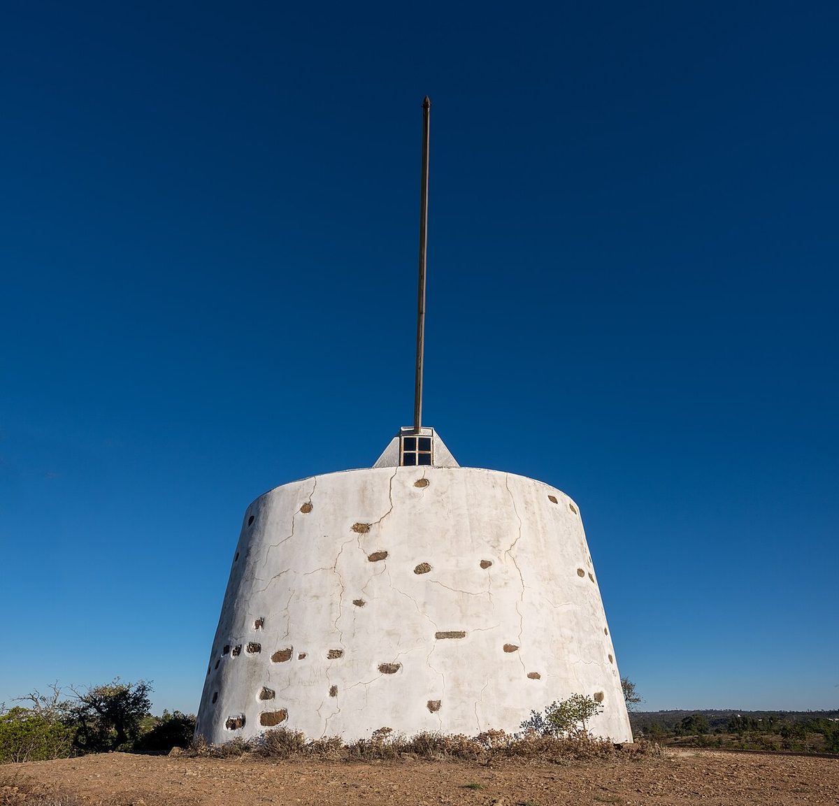
- Windmill on the Via Algarviana — Jules Verne Times Two, CC BY-SA 4.0, via Wikimedia Commons
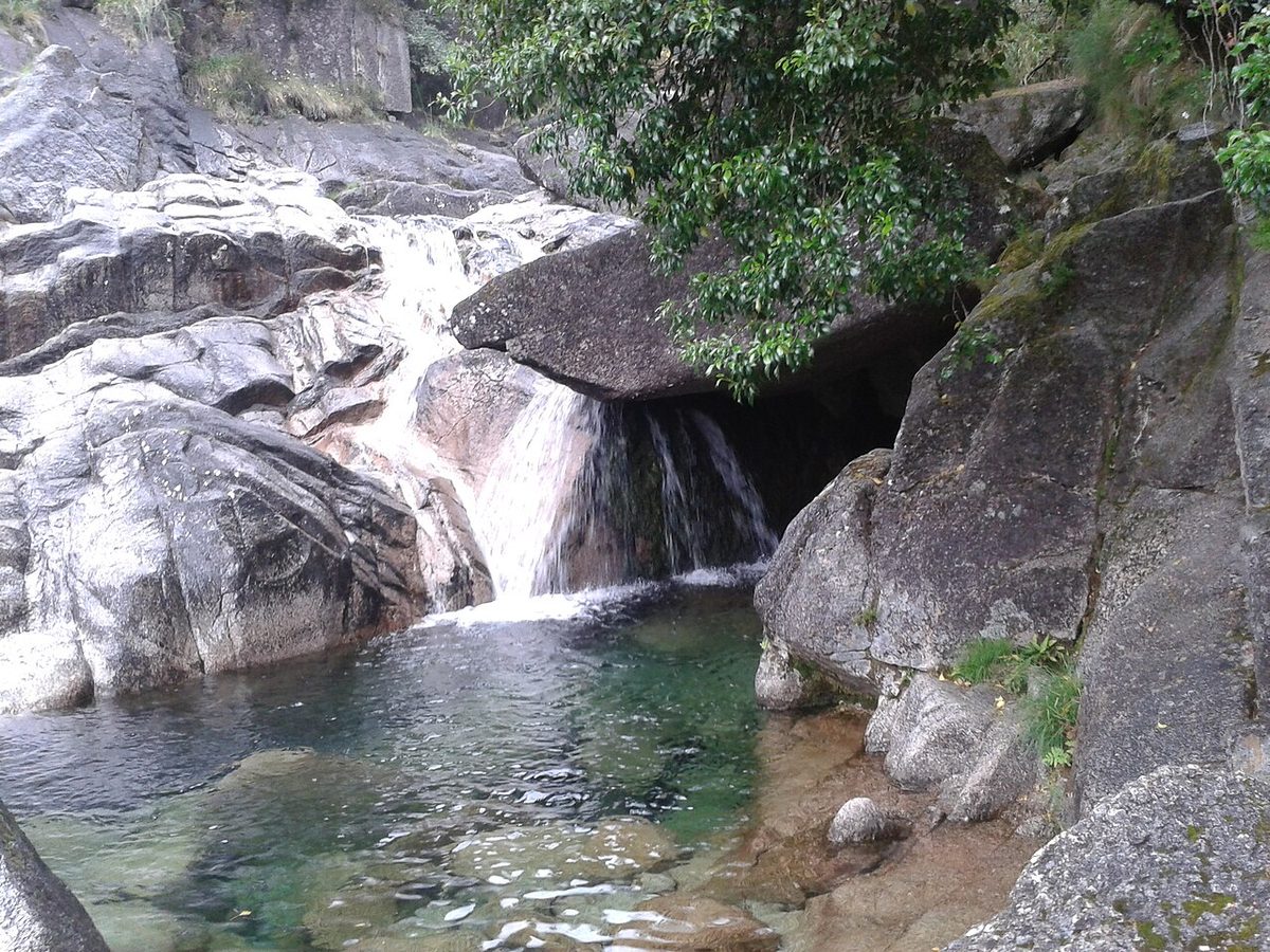
- The Paiva Walkways — Joseolgon, CC BY-SA 4.0, via Wikimedia Commons
- Covão d’Ametade, Serra da Estrela — InêsSilvaNina, CC BY-SA 4.0, via Wikimedia Commons
Trail lengths from the operators’ own figures where available; permits, fees and rules checked September 2026 against SIMplifica, 516arouca.pt, the Rota Vicentina and the ICNF. Rules for Madeira and Peneda-Gerês have changed recently, so check before you go. Last updated: September 2026.